
Selected work

Proof, not promises.

A growing record of schemes where the data-led approach earned its place — from live 3D viewers and drone Site Progress to cover meter surveys on major highways infrastructure. Every project pairs survey-accurate capture with hands-on site engineering: models the whole team can read, clashes and service strikes caught in design rather than the trench, and clear as-built records clients can actually use.

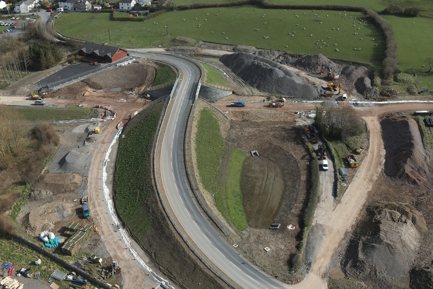
Grizebeck Highways Scheme — ISO 3D model view
Highways · Survey & 3D

Grizebeck Highways Scheme

Site engineering and surveying across the scheme — UAV drone mapping for terrain models and volumetrics, drainage coordination and structural cover meter surveys. Highly accurate surface data lets us compare existing conditions to proposed levels, with a timestamp of where the site was on any date — so quantity surveyors can see exactly what has and hasn't been done.
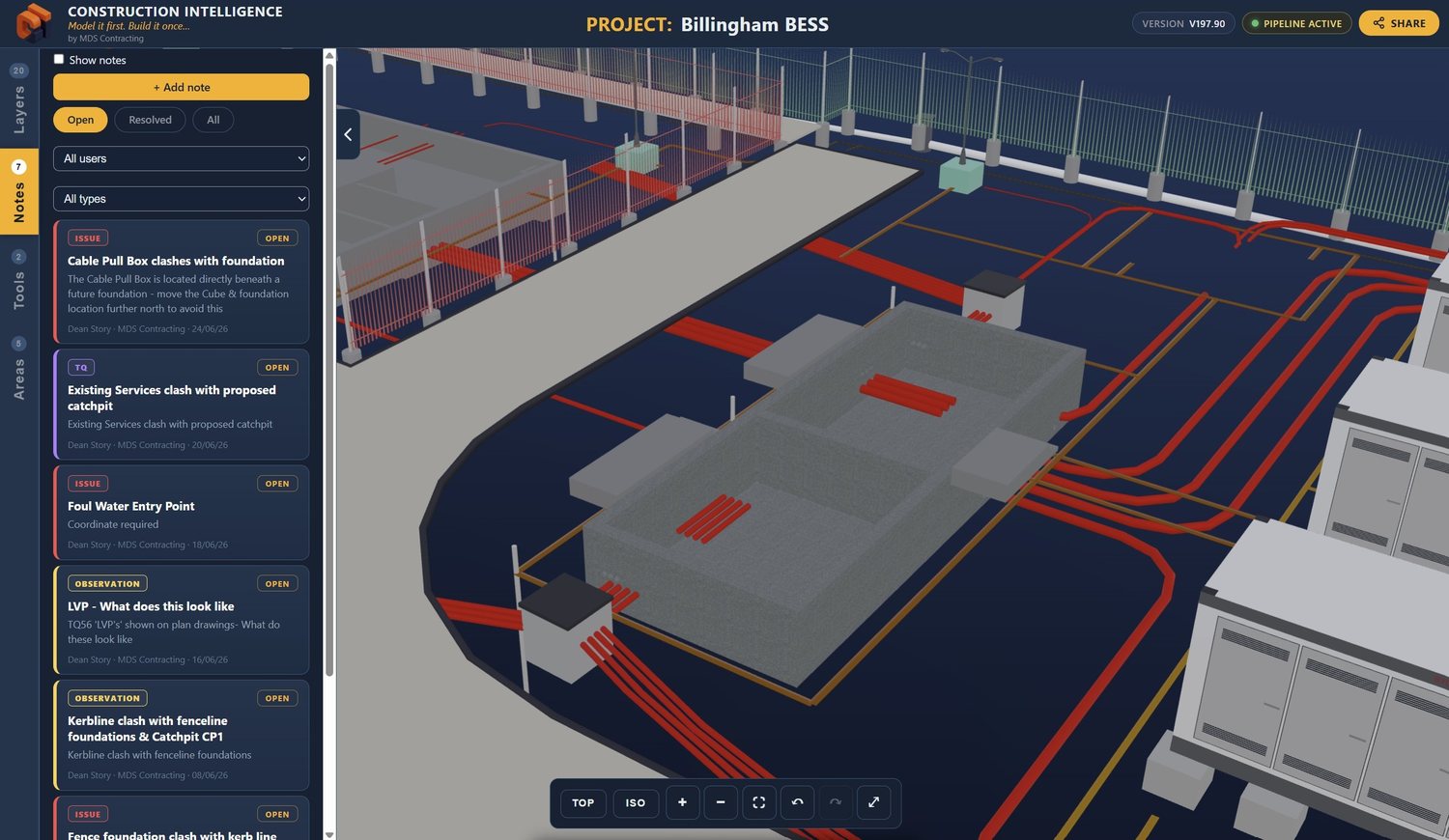
Billingham BESS — Construction Intelligence 3D viewer
Construction Intelligence · Live Data

Billingham

Six weeks before a bucket went in the ground, Technical Queries raised from the 3D model led the designers to amend the civils scheme — problems caught on screen, not in the trench. Intelligent drainage trackers set up across the scheme — quantity surveyors get live data from site: installation date, which contractor or team installed each run, check sheets and as-built data.

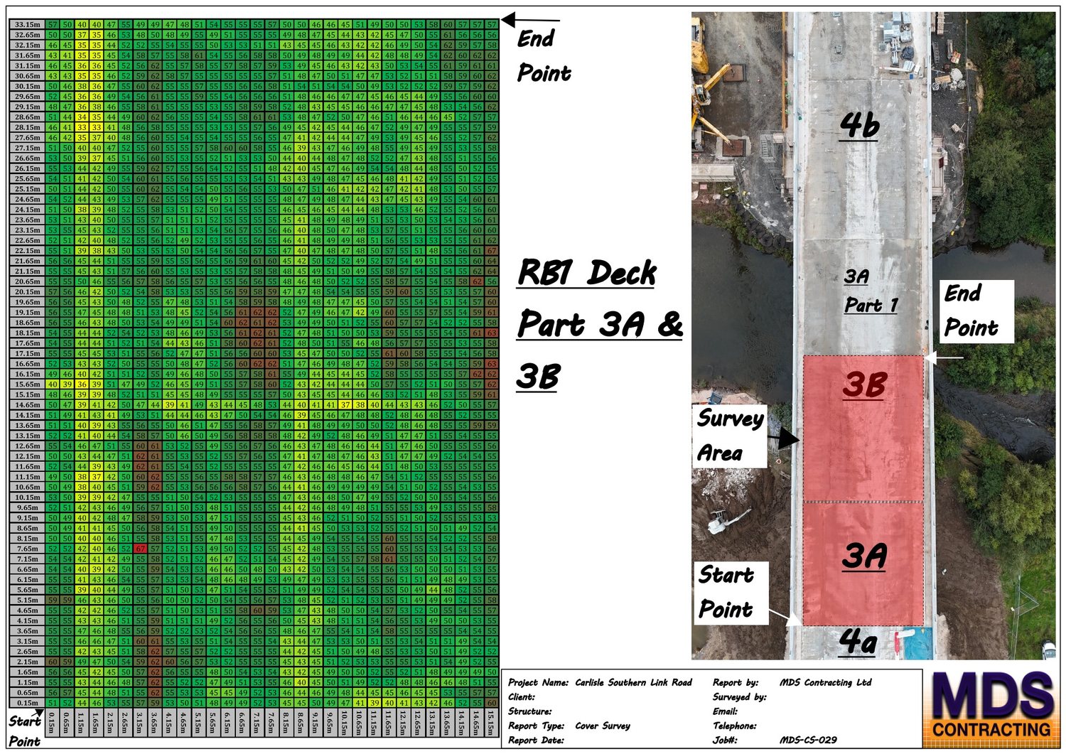
Cover meter survey heatmap of the RB1 deck on the Carlisle Southern Link Road, showing concrete cover over the rebar
Cover Meter · NDT

Carlisle Southern Link Road

Cover meter surveys across major infrastructure — generating heatmaps so the client can easily see where there's too much or too little concrete cover over the rebar.

Site Engineering

CSLR — Road Bridge 5

Full site engineering on a major road bridge — setting out and supervising reinforced concrete structures, retaining walls and drainage, with temporary works coordination, materials testing and accurate as-built records throughout.

How we work

Capture, model, keep you in the data.

01

Capture the ground truth

Every engagement starts with real data — survey-grade drone capture and on-site measurement — not assumptions. Existing services are surveyed and modelled in 3D, with detailed as-built records produced throughout.

SURVEY-LED
02

Model before you build

We build the scheme in 3D to find clashes, quantities and risks in the design phase, where they're cheap to fix.

DE-RISK EARLY
03

Keep clients in the data

Through Construction Intelligence, clients see live progress and explore the model themselves — not a folder of photos weeks later. Everyone on the scheme has access to the model — from the design team to the site operatives on the ground.

LIVE VISIBILITY

Start a conversation

Got a scheme like these?